Things to do locally...
-
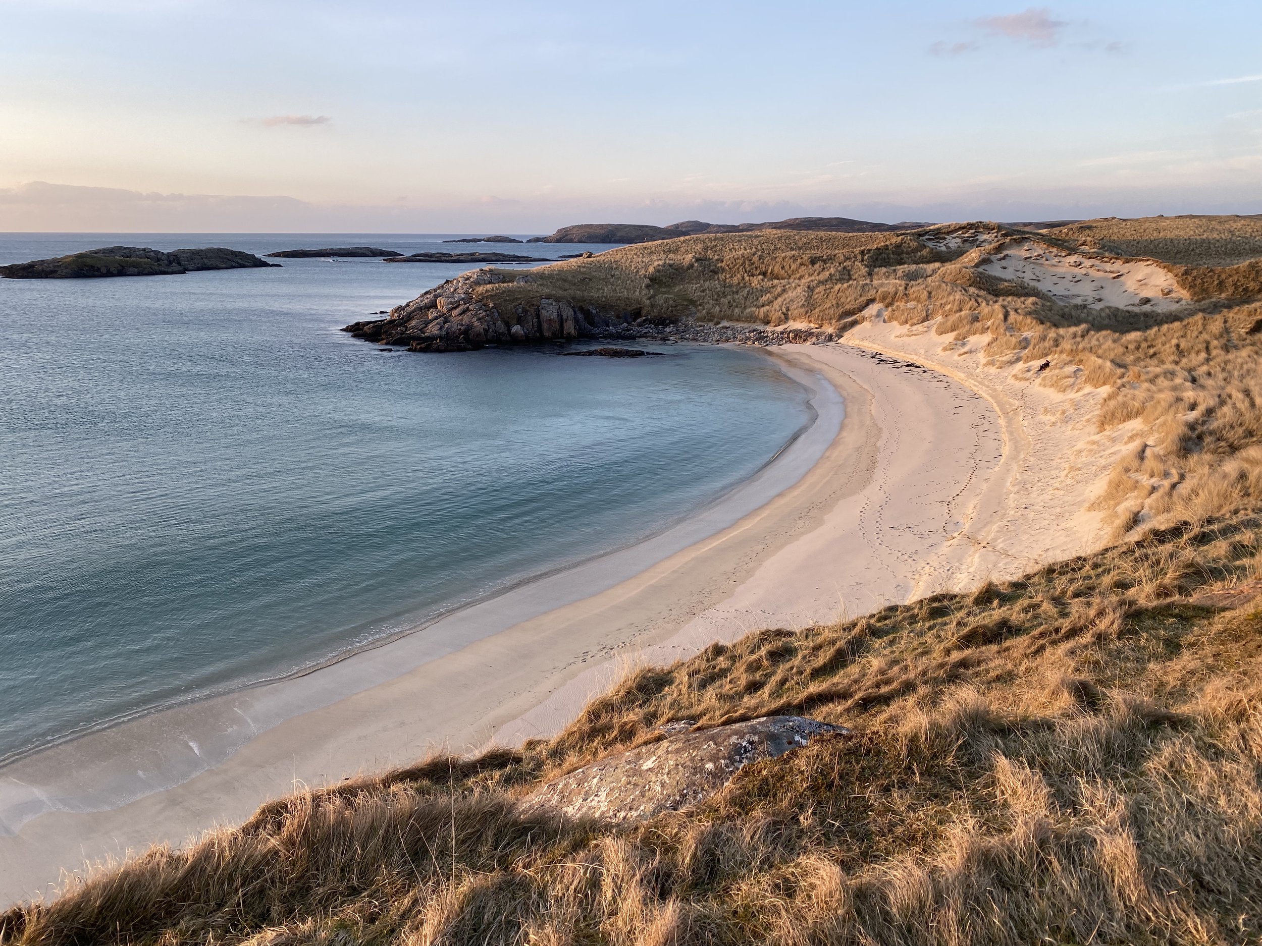
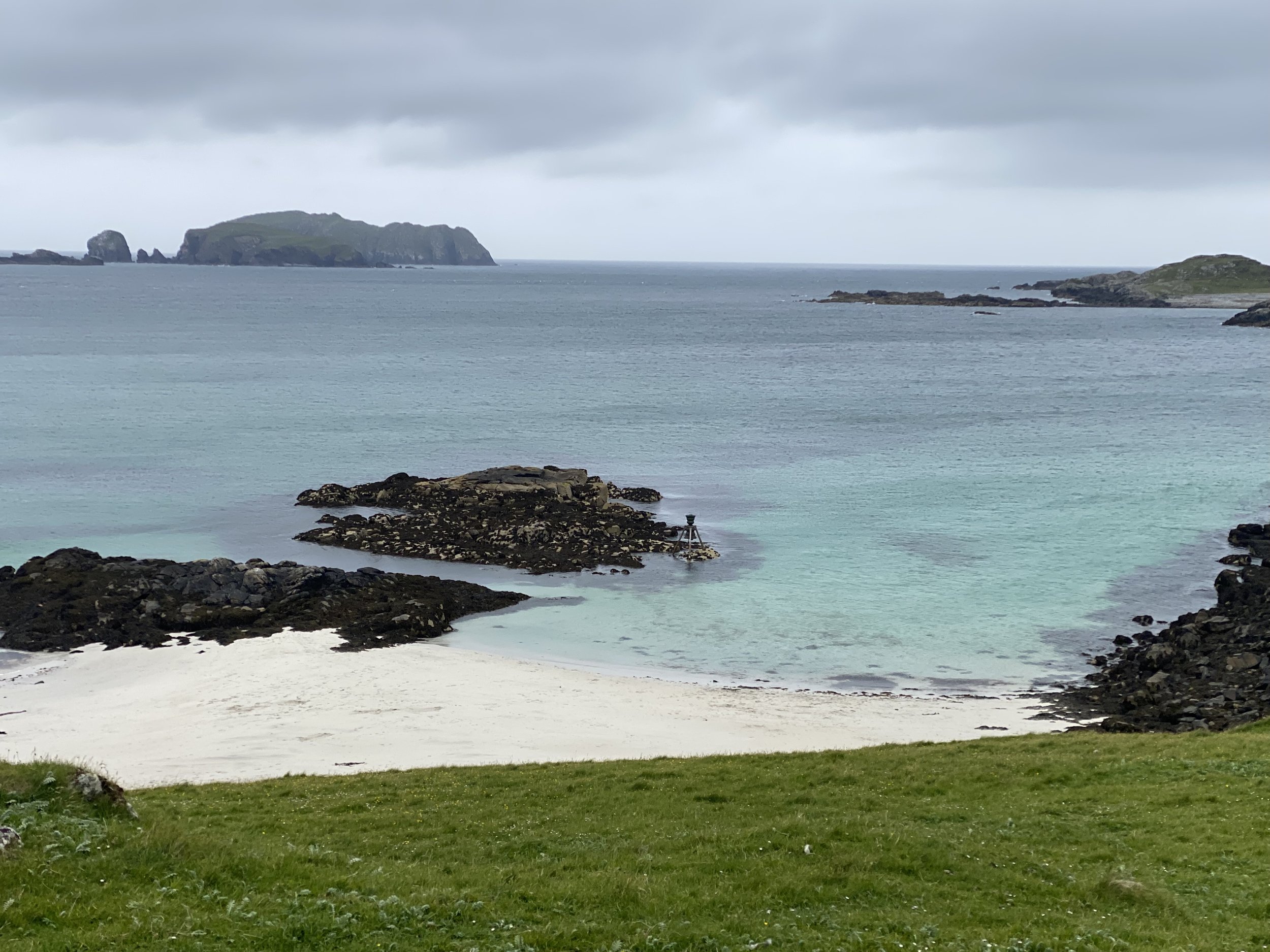
LOCAL BEACHES
You are spoilt for choice for beaches along the Uig coastline some within walking distance of the campsite and other a short drive away, but you will always be sure to find something breath-taking whatever the weather.
-
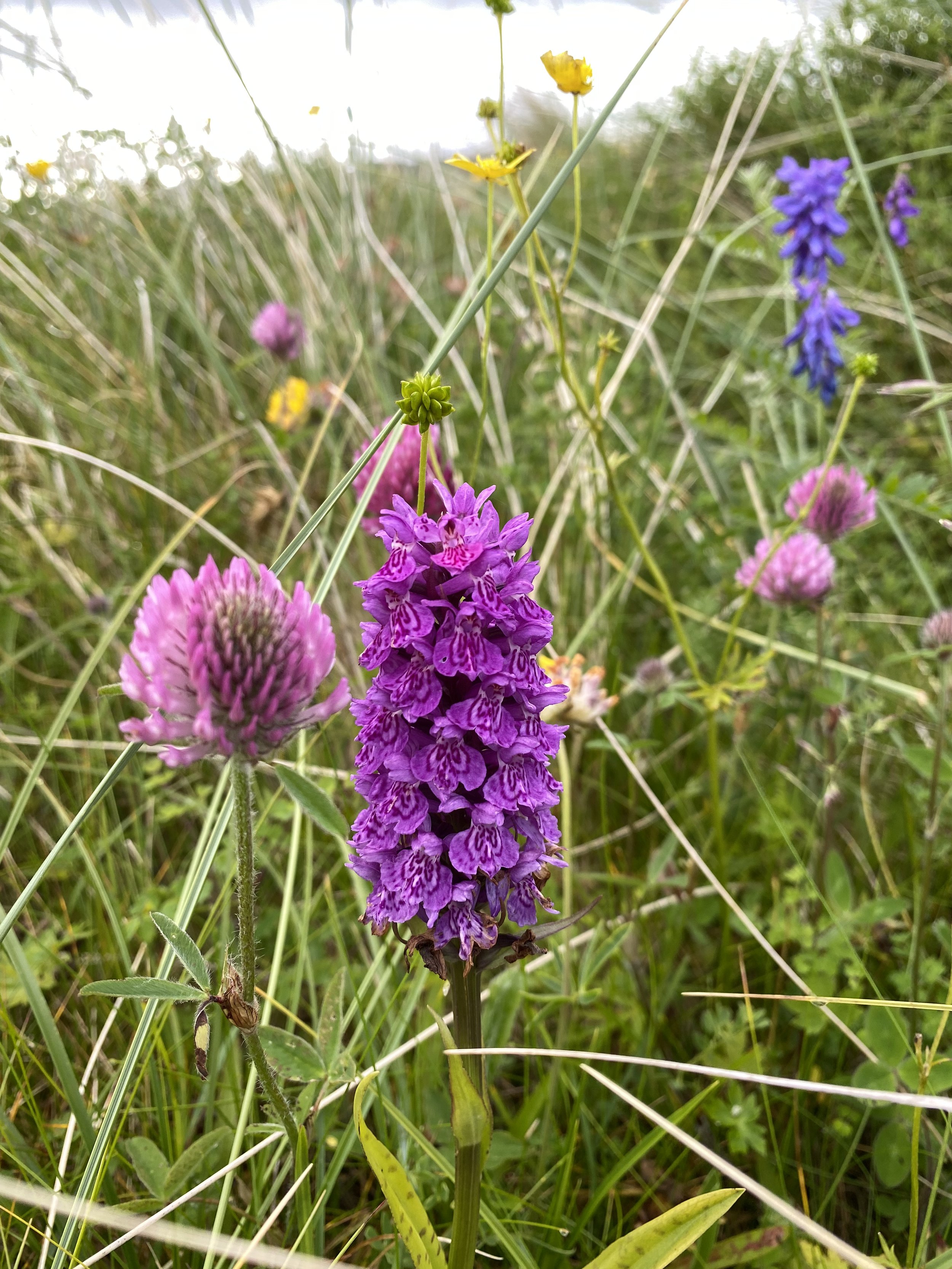
MACHAIR
Machair /ˈmaxə/ a Gaelic word meaning fertile, low-lying grassy plain; refers to our unique habitat that is one of the rarest in Europe. Common flowers (such as red clover, bird’s-foot-trefoil, yarrow and daisies) grow a lot here, along with a few rarer species such as lesser-butterfly orchid, Hebridean spotted orchid, marsh orchid.
-

AN SUILEACHAN (2miles)
Part of a wider series across the islands and designed by Will Maclean and Marian Leven to reflect local, historical events which started in the late 19th century and which are on-going into the 21st century. The Bhaltos Community Trust asked for a structure which would represent 19th century Lewis Land Clearances, 20th century land raids by the Reef Raiders and changes in Scottish Land Reform and community ownership of the Bhaltos Peninsula.
-

HILL WALKING
While Uig might not boast a Munroe there is still plenty to choose from with wonderful views across the ever-changing coastline.
-
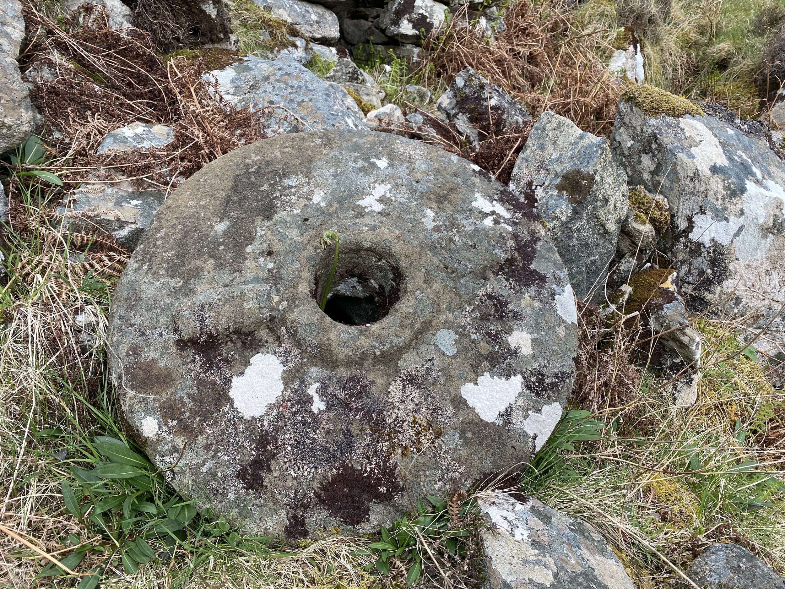
ANCIENT NORSE MILLS
There are many Norse mills dotted across the Isle of Lewis, a couple within walking distance from the campsite. One can be found across the wetland behind the campsite and the other above the waterfall at Cliff beach
-

SIDHEAN (1mile)
A small settlement on the eastern shore of the peninsula, behind Reef. If you walk south around the coast from Tràigh Theinis, you will come to an area where the grass is greener and there are raised ridges of soil. This site has a local reputation for being haunted, and has been known as a ‘sidhean’, or a place where the little people live.
-

WRECK OF ESRA (3miles)
Depending upon the tide and wind conditions, it is at times possible to see the remains of wrecks around the coast. The best known of these is the wreck of the Esra, a 3 masted sailing ship which ran aground at Clibhe (Cliff Beach) in 1898, and which is intermittently visible when the sand shifts. It could last be seen in 2000.
-
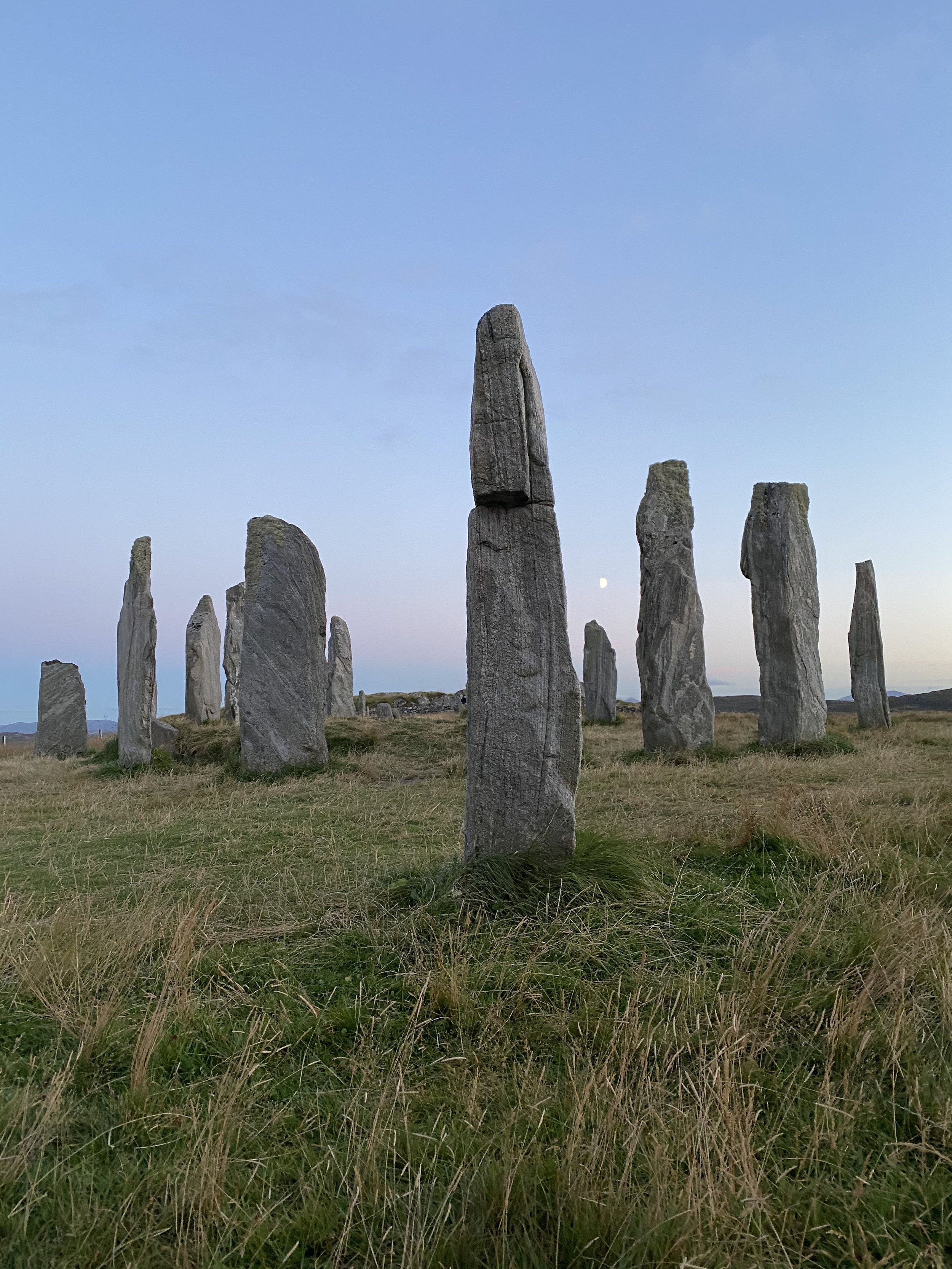
CALLANISH STONES (21miles)
The Callanais Standing Stones are an extraordinary cross-shaped setting of stones erected 5,000 years ago. They predate England’s famous Stonehenge monument, and were an important place for ritual activity for at least 2,000 years.
-
BOSTA BEACH (27miles)
An art project made up of bells, designed by UK sculptor Marcus Vergette and Australian bell designer Neil McLachlan installed at coastal locations in the UK. Each bell rings around high tide; the bells provide a reminder that rising sea levels caused by climate change will make the pattern of their ringing change.
-

UIG COMMUNITY SHOP (4miles)
Our very well stocked local shop has everything you need including a laundrette, book shop, coffee machine, post office and fuel. There is an excellent selection of local arts and crafts too. https://uigcommunityshop.co.uk/
-
UIG MUSEUM (4miles)
The museum is run by a small group of volunteers and is open from April to October, Monday-Saturday 12noon-4pm. Welcoming hundreds of visitors every year and giving them an insight into the social history of the local area. http://www.ceuig.co.uk/
-
RESTUARANTS (4-6miles)
Uig Community Centre Café, Edge café and Uig Sands are 3 local eateries all catering to different budgets. Serving local fare as well as homemade cakes and hot drinks.